The most recent food crisis has revived interest in irrigation in Sub-Saharan Africa, especially as the Food and Agriculture Organization (FAO) estimates that Sub-Saharan Africa has attained less than 20 per cent of its irrigation potential. The New Partnership for African Development (NEPAD) argues that the irrigation area needs to expand by 6 per cent per year, six times the current rate of increase, and governments of Africa and the donor community are now looking at serious new investments in irrigation infrastructure.
Historically, the costs of irrigation development in Sub-Saharan Africa have been higher than anywhere else in the world and the economic performance of many schemes has been disappointing. Crop yields still fall well below potential because water and nutrients are not applied according to the demands of the crops. Low productivity feeds into the second problem, which is the abandonment of irrigated lands when unmaintained infrastructure fails. Salinity and waterlogging are serious consequences of poor water management over the longer term.
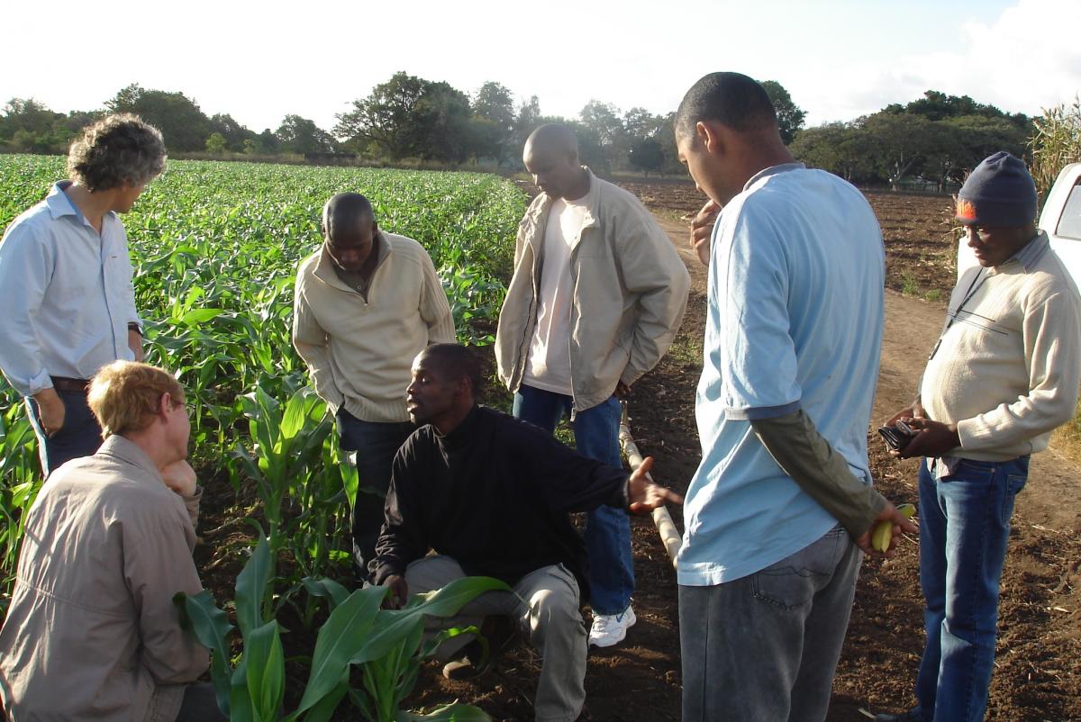
A recent study from the International Water Management Institute showed that the performance of irrigation in Sub-Saharan Africa is slowly improving. Some of the main contributing factors to this improvement include involving farmers in operation and maintenance of schemes, training agency staff and farmers in water management and moving to higher value crops. This project aims to bolster this trend through the development of a simple inexpensive soil water sensor which can help farmers and other managers of water to understand the consequences of irrigation decisions. The new sensor gives an output resembling a traffic light i.e. green (plenty of water) orange (transition) and red (running out of water).
The design of the traffic light sensor combines an understanding of the physics of soil water measurement techniques and the social process of adaptive learning, particularly amongst smallholder farmers. The sensor must be low cost, sufficiently accurate to give reliable information to farmers, easy to interpret and be amenable to local manufacture. Currently there are no low cost water sensors on the market with the desired accuracy, and certainly nothing that could be built in a developing country context.
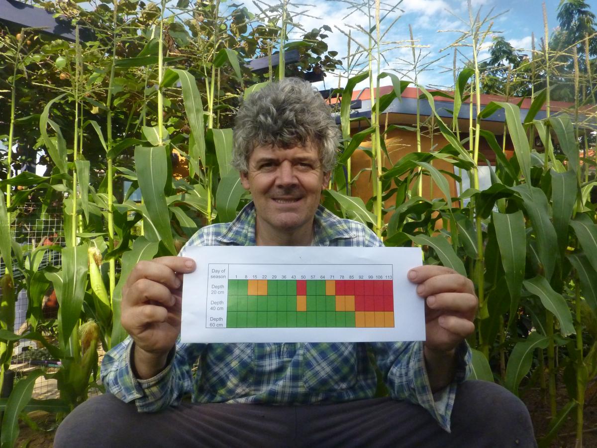
A smart phone app is being developed which displays a picture of the sensor deployed at three depths. The user records the colour pattern from the field sensors directly onto the phone screen and sends the information as a text. The data is picked up on the web, date stamped and displayed as a graphic that non specialists could easily understand (see image below). The three depths are displayed as rows, time progresses from left to right and the colours provide the third dimension showing soil wetness over time and soil depth.
For farmers with a reliable and low cost water supply, applications include providing information on when to irrigate to avoid water stress, how to avoid waterlogging, when the profile is susceptible to fertiliser leaching and improve the usefullness of rainfall. This will lead to increased yields due to better resource input efficiency and reduced environmental stress and degradation. For farmers with a limited or costly water supply the sensor is needed to improve the use of the water available. Water can be limited due to physical limitation (small dam, roof rainfall harvest) or due to labour (distance to be carried in buckets) or cost (e.g. fuel for pumping groundwater).
Since the data from each sensor is geo-referenced by the phone and can be displayed on Google Earth, the information could be used in a governance context for diagnosing and negotiating where improvements can be made in irrigation scheme management, irrigation infrastructure development or in watershed development. The sensors can be widely distributed at an irrigation scheme scale to evaluate systemic management issues such as ‘wetness’ (over irrigation) at the top end of the canal/ scheme and ‘dryness’ (water scarcity) at the bottom end of the canal/scheme. Also frequency of water supply (extent of drying between irrigations) effects can be demonstrated to system managers.
A traffic light soil water sensor for resource poor farmers is a short (nine month) project to take the ideas above to proof of concept stage. Essentially there are three separate elements to the project – the design and testing of the simple sensor, the development of a low cost reader for the sensor and the development of the smart phone apps. The research on sensor and smart phone apps is being conducted at CSIRO Land and Water in Canberra and Brisbane, whereas the sensor reader is being developed by Measurement Engineering Australia Ltd based in Adelaide. The first full field test of all three elements will start in July 2013 with our Mozambican partners at Eduardo Mondlane University.
By Project Leader Dr Richard Stirzaker, CSIRO Land and Water